
12.8797° N
121.7740° E
UK, USA
LAUNCHED 2024

GLOBAL OPERATIONS
PRIORITY MARKETS
AI and Satellites: Connecting Space to Earth
US
GLOBAL OPERATIONS

SINGAPORE
HQ
GLOBAL REACH
How RIFFAI Works?
RIFFAI uses multiple source data integration—including GIS, weather forecasts, and classification indicators with space and geological data—into an AI model that predicts, classifies, and quantifies change.
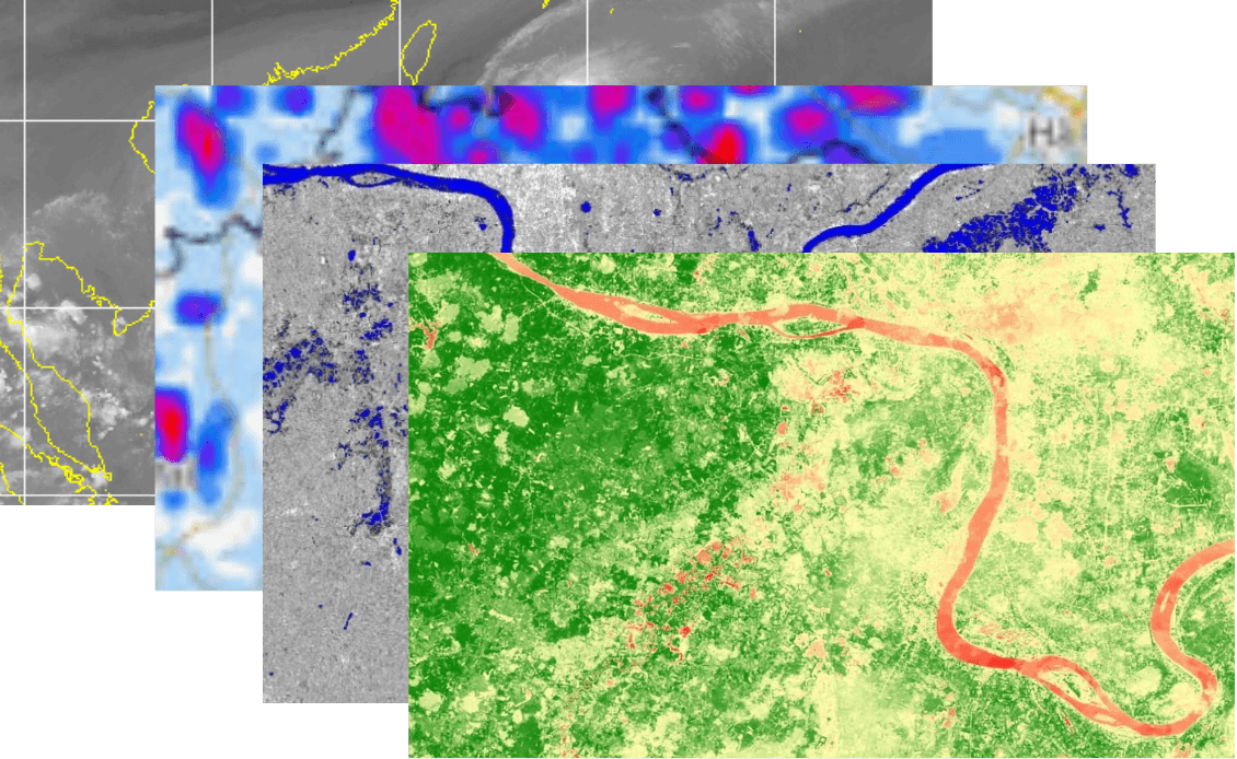
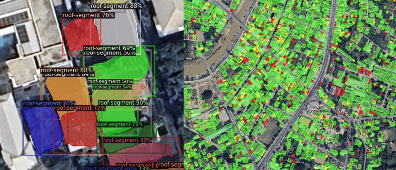
Intelligence Image Recognitions
RIFFAI employs over 1B+ parameters in satellite imaging to detect environmental changes and critical infrastructure, building indices for long-term monitoring and rapid event identification.
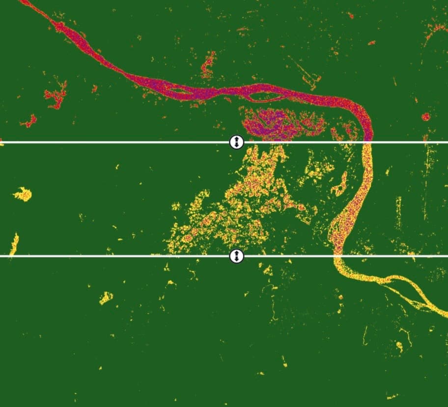
Temporal Change Detection
Time series analysis keeps tabs on specific locations over long periods, automatically quantifying anomalies and events—whether environmental change, deforestation, or flood impact—between precise time steps.
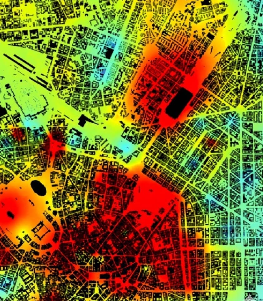
Integrated to Decision-Ready
RIFFAI turns advanced geospatial analytics into actionable intelligence via executive dashboards and developer APIs so you can make decisions in minutes, not months.

AI Model Validation
and Actionable Intelligence
Our intelligence pipeline is built on patented technology and proprietary AI to transform raw satellite data into reliable, decision-ready insights for enterprise and government customers.
View Case Studies↗Trusted by high-stakes customers and partners, including government agencies like the Geo-Informatics and Space Technology Development Agency (GISTDA) and industry leaders such as GEPP SA-ARD and Panasonic.